MainelyDrones
Precision Data for Farmers and Builders
If you have 30 acres of strawberry plants — say 500,000 plants — and 2% of them fail, will you find every last one of them in time to replant? Or will you lose that $20K in sales?.
If we get those terrifying April and May freezing nights, will you know exactly where the cold spots in your rows are? Do you KNOW that every sprinkler reaches every plant?
Our specialized drones can fly your fields and provide you with real-time information, the kind that lets you make decisions when they NEED to be made.
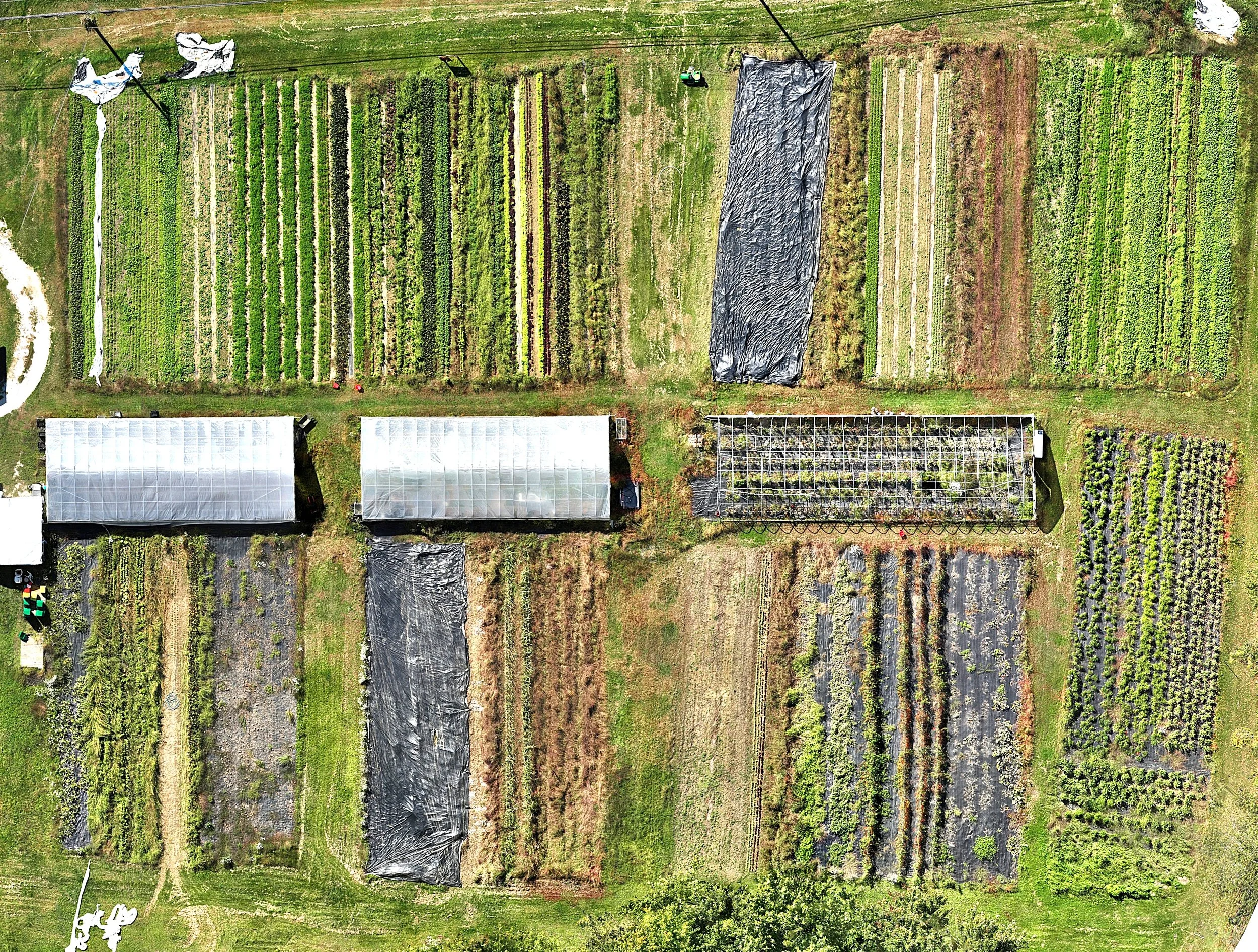
Whether it’s an estimated elevation/drainage map, a seedling count, plant health assessment, weed detection, or nutrition deficiency, our drones can delivery it all. And we can monitor all of that over the entire season.
Tell us how we can help you.
We can do a free trial for you to see if you find it valuable. Give us a call or drop us a note.
Eighteen trucks delivered to your construction site today. Can you estimate what and how much they unloaded? Was it 20 yards of clean fill or was it more like 18?
Our enterprise-class drones, with their high-resolution cameras and mechanical shutters, and their GNSS position corrections, can give you all those answers. Answers you can count on and that you don’t have to wait days to get.
Did the new site get completely cleared this week? Can you tell the property owner exactly what goals were met this week? Can you show him the photos and videos that mark the progress on their project?
With every flown mission on your site, we’ll get the 4K video and the carefully composed photos that record every step of the way — for your client, and for you and your marketing department.
We’re happy to trial-fly your site and show you what we can deliver.
Give us a call or drop us a note.

Some of Our Deliverables
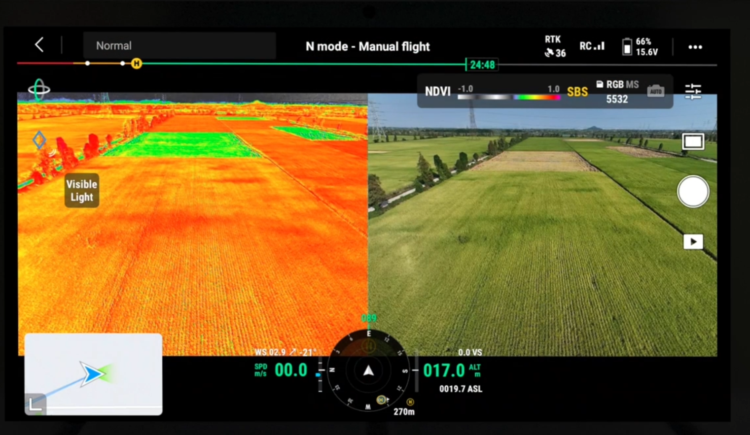
Live Split View of RGB/Multispectral Imaging Flight.

Parking Lot Measurement for Repaving at Local Church. High-res orthomosaic image for estimation by MainelyDrones.

Roof Work Status Check at local elementary school. High-resolution image by MainelyDrones.

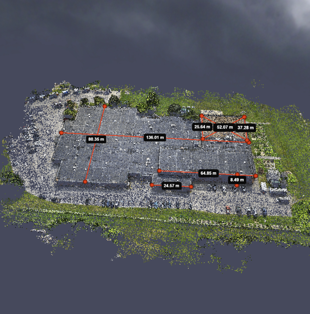
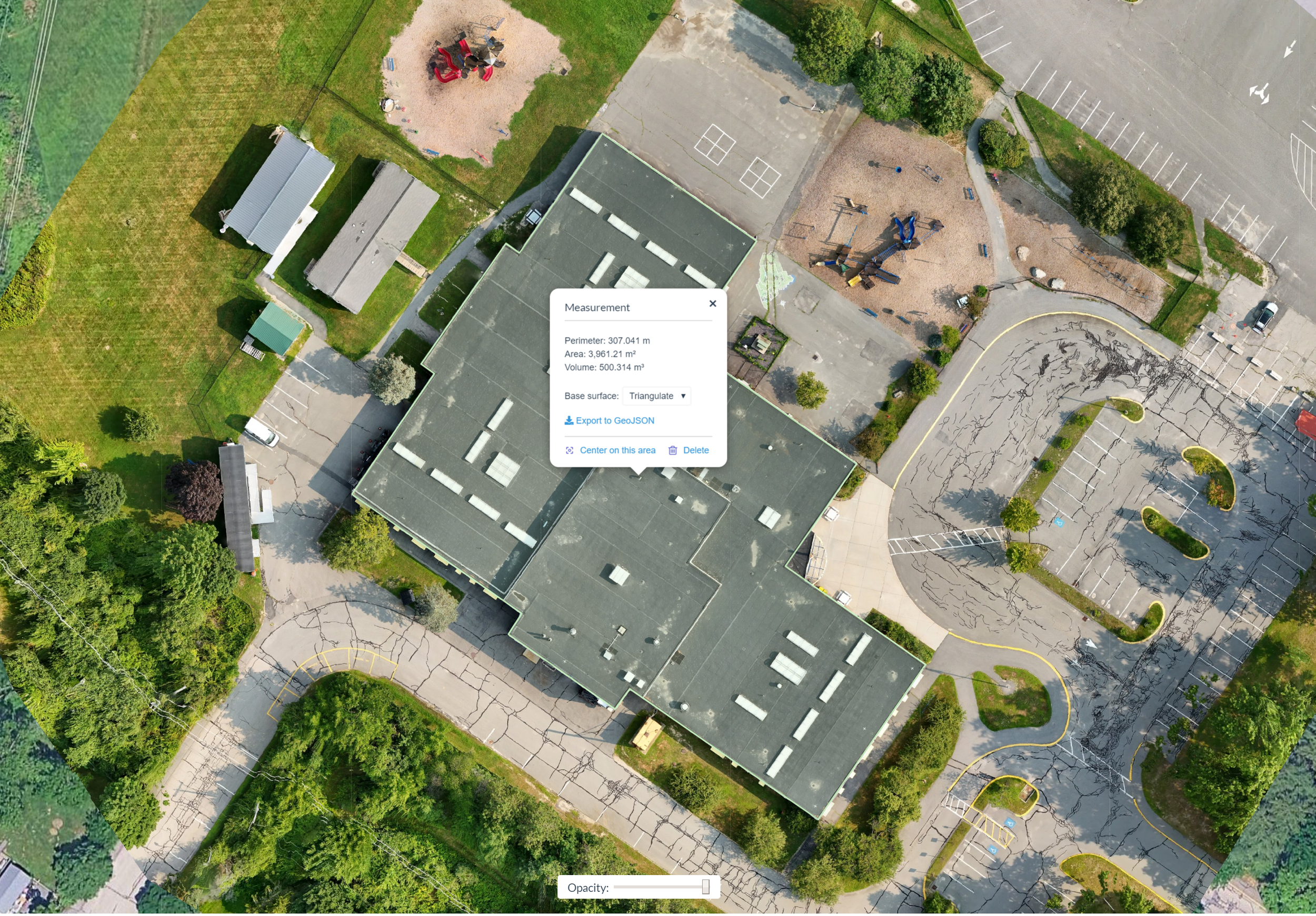
Roof area estimates from a 3D model of a community center. Image and 3D Model by MainelyDrones.

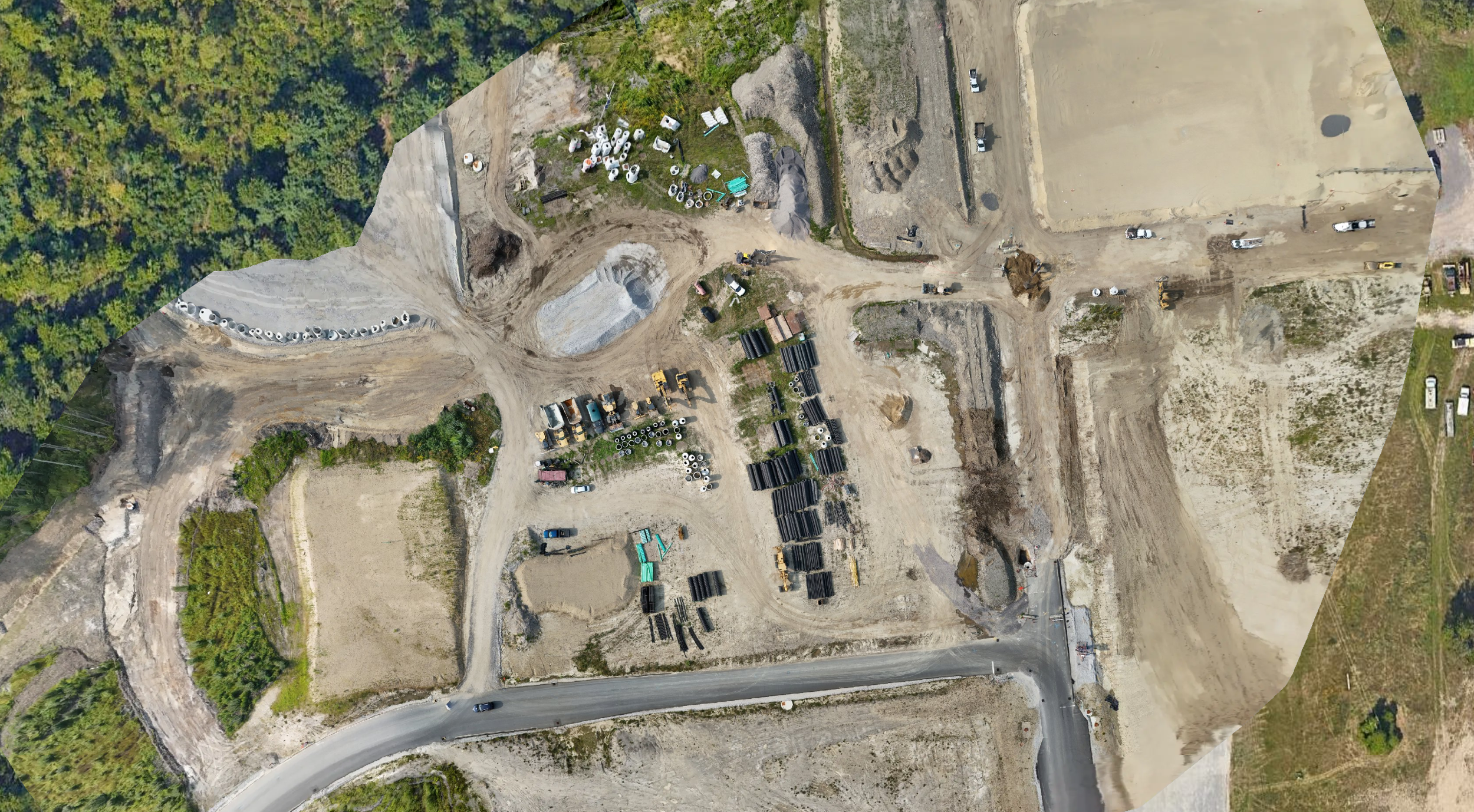
Static Image taken from 3D Model of Construction Site. Image and 3D model by MainelyDrones. This model can be used to estimate the size and volume of materials and earthworks.
Roof Inspection and area estimates taken from an orthomosaic image by MainelyDrones.
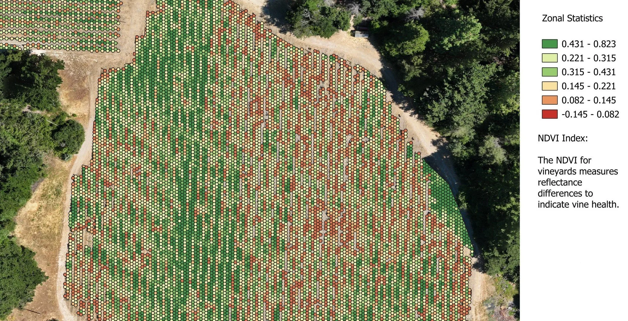
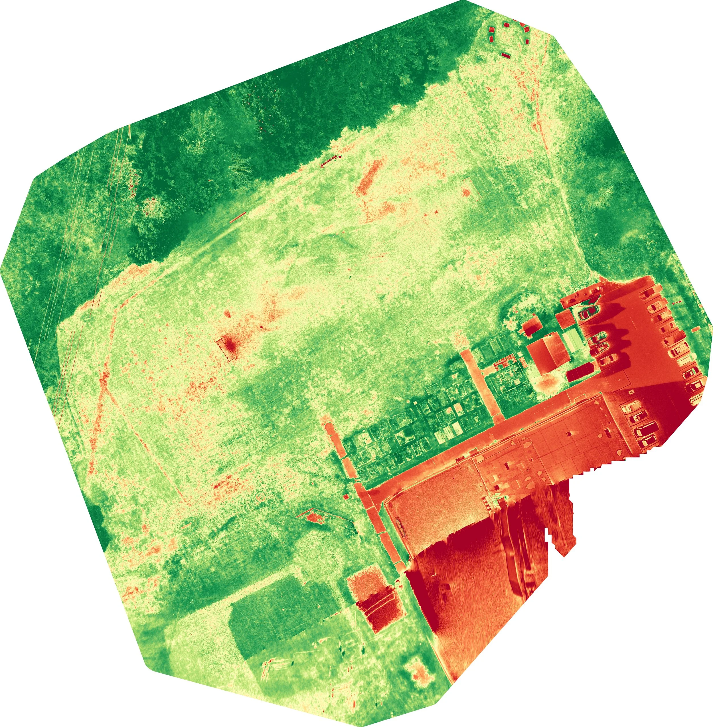
Multispectral Image of an Orchard

NDRE Image of Soccer Field by MainelyDrones